Sciences
We develop the tools you need to analyze and share the results with your colleagues

Multiply field experiences
Collaborate in real time

Accelerate understanding of your data
Prepare your content for publications
Technological innovation at your service
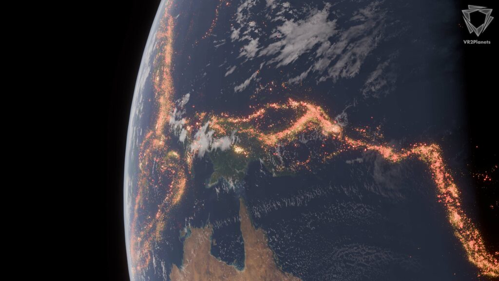
Visualizing Earth’s Seismicity
Interactive 3D visualization of 520,000 global seismic events from 1964 to 2025. This collaborative project with Osuna transforms raw earthquake data into an immersive environment where major tectonic fault lines emerge naturally from the spatial distribution, revealing Earth’s geological architecture at unprecedented scale.
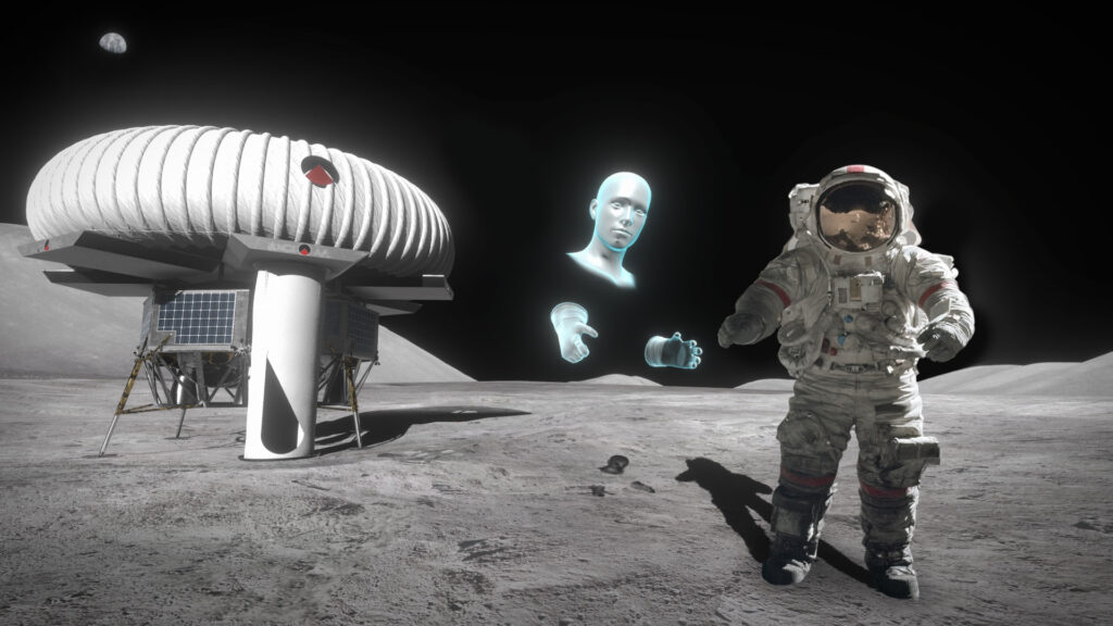
VARIA
VARIA, Virtual and Augmented Reality with artificial Intelligence for Astronauts is a project funded by the CNES (space French agnecy) under the supervision of the SpaceshipFR in the framework of the TechTheMoon incubation.
The purpose of this work is to study the innovative tools bringing new
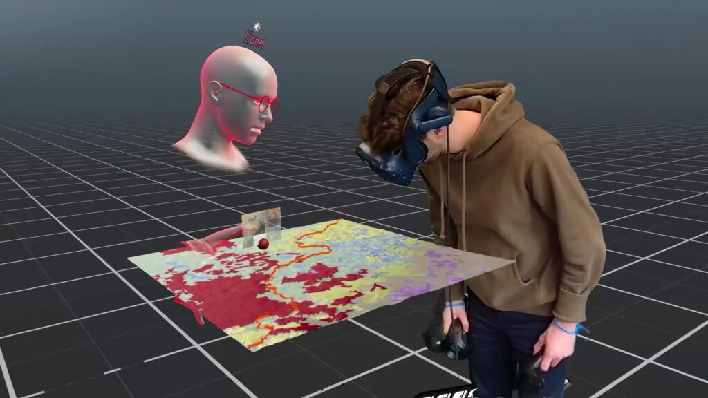
VRExplorer
VREXplorer is the first immersive, collaborative platform for loading digital terrain models into virtual scenes shared in real time between remote users.
This tool, originally created for geoscience teaching, allows users to import 3D data in a variety of formats (Digital Elevation Models, 3DTiles, point clouds) and visualize them in shared environments where they can see, talk and analyze the terrain in real time.
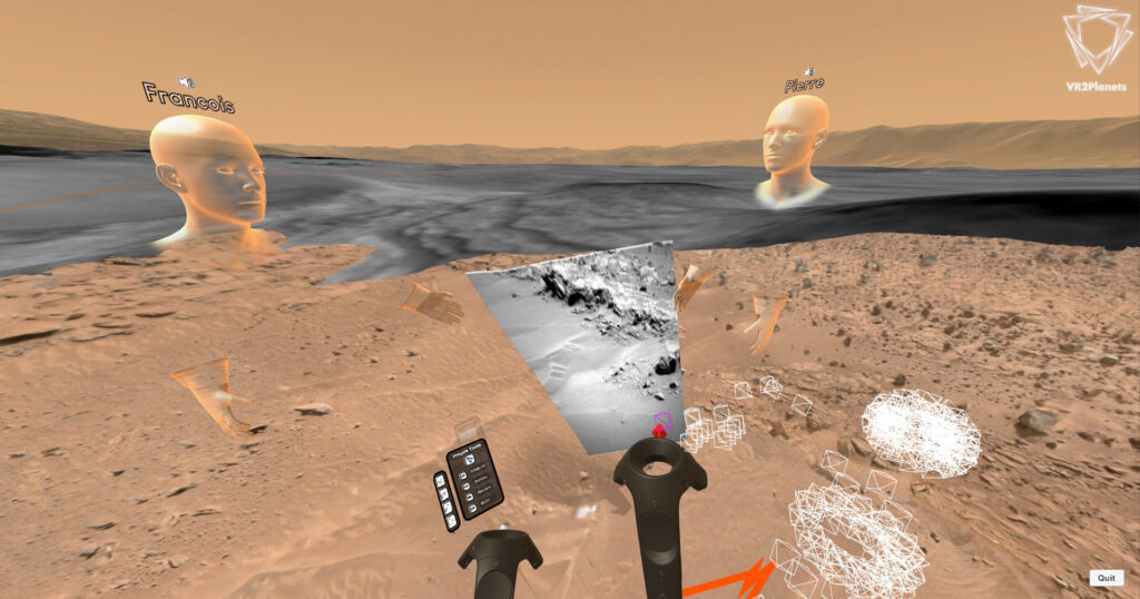
PLANMAP
As part of the PlanMap project supported by the European Commission, VR2Planets has produced a collaborative immersion analysis software on a Martian site.
This software has been used by many students and several astronauts to prepare for future Martian missions.
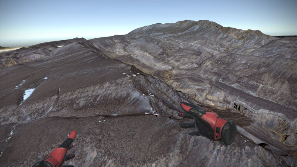
Djibouti
As the area of scientific interest had become militarized, a solution had to be found to continue geological studies of the area. VR2Planets was commissioned to create a virtual environment from very high resolution satellite data and provide the measurement tools necessary to understand these environments.
Let’s build your idea
Attuned to your aspirations, we are ready to take on the challenge of realizing your goals.
Contact us now for an innovative and successful collaboration.